( Mt Baker from Heliotrope Ridge)
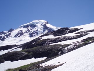
Last weekend I climbed Mt. Baker with my class from Pierce college. Mt. Baker is 10,778ft and located in the North Cascades just south of the canadian border. It is heavily glaciated and also the second most active volcano in Washington state.The trip started as soon as I got off work of friday, when met up with mark and we braved traffic and 130 miles of I-5 to reach the mountain. We met our instructors Ken, Chris and Dan and had dinner in Bellingham and then we all spent the night at a campground near the foot of the mountain. We packed three cars into a one car campsite and set up our tents by headlights, but it was a good night. I splept well, and had plenty of time to get ready in the morning.
At 0900 on the 8th, our class met at the Heliotrope ridge trailhead at Mt. Baker and we headed out to the glacier. Even in the morning it was alreday too warm for me, and I glad when we started to get some cloud cover. After 2.5 miles and half a dozen stream crossings, we were at the foot fo the Coleman glacier and started to rope up. Much of the snow had melted out and there were waterfalls and streams of snowmelt everywhere. There were also several other rope teams on the same route, and so it took us a few hours to get to high camp. Just below high camp, there was an area in the glacier with dozens of crevasses, and so we went around it, and then set up 100m upslope from where everyone else had camped.
Once we got to high camp at around 1400, there was much to be done, and only a few hours before bedtime. We had several tents to set up, and then Dan and I sat down to eat dinner and melt snow. I amazed my civilian classmates with my MRE and it's food and water heating capabilites. Then there was some gear rearranging, more training and we went to bed at about 1900 with a view of the summit out the tent window.
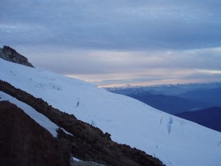
At 0145 Dan woke me up. I wanted to sleep longer, but got up and got ready to go. At 0235 we were all roped in and left high camp bound for the summit. I was on the last spot on the second rope. The pace was easy, and I had enough time to look around as we climbed higher up the mountain. Down below I could see the lights of the city of Bellingham, and in the sky were shades of sunrise, even at 0300. We crossed several crevasses on the route, and had to jump over a few. The rest were small enough to just step over, or we went around them.
At around 0530 we reached a small platform of snow at the top of a steep slope and took a break. The view was breathtaking. On was side was the whole Puget sound region, including the Olympics, and the islands, and to the east and south thewhole cascade range was spread out before us, with the rising sun giving an orange hue to the all of the taller peaks in the range.

( Left: Part of the sunrise. It wwas better, but those pictures didn't come out for some reason. Right: The Roman Wall)
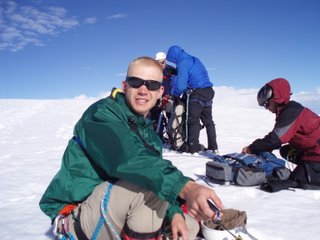
We stayed and took pictures for a few minutes as we each made it to the platform, and then coiled in the ropes and continued up some switchbacks on a rocky lava ridge until we reached the final stretch known as the Roman Wall. The wall was very steep, and every time I looked down I felt a little afraid, but the view was so amazing I couldn't help but look down and gape every chance that I got. Soon I was used to the view and was no longer afraid of the height.After an hour of climbing the Roman wall, we reached the pleateu, coiled in our ropes, and walked across to the small hill that was the true summit. There was a small metal box that had been there for ages and I signed the summit register that was inside. It was quite windy at the top, so we stayed only long enough to take pictures, and get some food and drink for the trip down. Since Mt. Baker is an active volcano, we could smell the sulfur at the top. It took five hours to reach high camp from the summit, and going down the roman wall was even more tiring that going up it. I fell a few times, but my trusty ice ax always kept me from going far.
It turned out that our timing was perfect. By the time we had returned to high camp and large lenticular cloud had descended on the summit, and we could tell that the conditions were white out and miserable up there. An hour later it started to rain on us in the valley.

(Mt. Baker from the Coleman Glacier)
The rest of the trip was uneventful, except that the descent was much longer and more tiring than I had anticipated. It is now three days since the trip and my legs are a little sore. I am sure they will heal in time for a trip up the Mazama glacier on Mt. Adams in 3 days.


4 comments:
I'm so proud of you. I wish I could have been there. I'm glad you had fun. Have fun and stay safe on the Mt. Adams summit!
Congratulations, John! I am proud of you...I think the pictures came out great. Good for you!
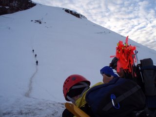
Congratulations! I am so happy you made it. I am not surprised that you did though. What is the red stuff in the third picture? The pictures are so beautiful.
The red things in the third picture are called wands. They are used in route finding in snow. They are about 3 feet long and have a red or pink tail. When traveling roped, the leader will set out wands along the route, and when the last person reaches that wand, he will call "Wand" and the leader will set another one. That way, if the weather goes completely bad, the team wil be able to follow the wands back home.
Post a Comment