Monday, December 04, 2006

A bad day

Sunday 04 December 2006

My wife had gone shopping at the Wal-mart with her mother. I was at home reading about Mt. Hood on the internet and contemplating a summit attempt this winter. Our basset hound was asleep behind me and the twins were taking their afternoon nap in their room.

A glance at the clock revealed that my fears might soon be realized. Nap time was almost over. Over the baby monitor I hear a loud, blood curdling whine. Something wasn’t right. I tiptoed over a cracked the door to their room open an inch and peeked inside. What I saw horrified me. As they napped, they had metamorphosed into scaly gremlins with huge fangs and razor sharp claws. Each of them had two tails with pointy spikes on them. For now, they hadn’t seen me and were content purring in their cribs and contemplating what to do with their new powers.

I didn’t know what to do. I quietly went back to my room so I could listen to them on the baby monitor. I hoped it was just a dream and maybe I would wake up soon. In despair, I called my wife and told her what had happened, but she didn’t believe me. She laughed and said there was nothing to be afraid of. If only she knew. Even as I was talking to her I heard a loud CRUNCH over the baby monitor as one of the bit into the crib with their bone breaking jaws. One of them was saying they had to go potty, but I knew it was just a ploy to lure me into their trap. After my wife still refused to believe me, I hung up and decided to try to prove it.

My plan was to open the door, snap a few pictures and run. I got the good camera, turned it on, and walked slowly to the door. I thought I had been as quiet as possible. I held the camera tightly in my right hand and the door in my left. I turned the knob, swung the door open, and pressed the shutter button.

When I regained consiousness, I was lying flat on my back in the hallway. The camera was intact but a few feet away. I had a headache and my ribs were sore. I stumbled to my feet and looked around. I was relieved that Boo was unharmed. I heard laughter in the kitchen and found them sitting at the table painting, looking just like normal children. I went back to the camera to see what it held. Maybe now she’ll believe me…,


Saturday, December 02, 2006

A record setting month...


November has been unlike any month I've ver seen. In the first 10 days we record setting flooding that cost 30 million dollars of damge to Mt. Rainier National park, and closed it for months. Immediatly after I came back from Thanksgiving in California we had 4 days of snow, and a record low of 16 degrees. I don't like not being able to go to Mt. Rainier, and I don't like driving on black ice, but the rest was fun. Now I have snowshoes and crampons, so I hope we get feet of snow.

Tuesday, November 14, 2006

Snow lake


After many weeks of being to busy to hike, or having no one to go with, I was finally able to get out and go hiking this Veteran's day. It was long overdue, because my last opportunity to go hiking was over labor day weekend. Even though I had the time, I still was not sure that we would actually be able to go because of the heavy rain and flooding of the few days prior. Charles was not availible until 1pm and he would be in Issaquah, so I decided to do my first hike in the I-90 corridor. Up until now I had avoided I-90 because of the crowds but now I didn't have a choices. The weather forecast called for heavy snow above 2500ft and high in the 30's. A perfect day to go hiking.

It rained pretty hard as we were driving up to exit 52, and I was wonderng what the trail would be like and how far we would make it. The rain seemed to turn to snow just as we got off the freeway at our exit, and much my our surprise we were driving through an freshly fallen winter wonderland. I had expected to see snow, but I was not at all expecting a few feet to have already fallen. It took us some time to find the trailhead and get dressed up for the weather and we started at about 2pm.

This was my first actual hike in the snow (the others being glacier climbs) and I enjoyed the new experience immensely. I loved the way that everything is quiet and peaceful in the snow. All the snow was freshly fallen powder almost waist deep, but the trail was hard packed and easy to walk on. We traveled slowly to take it all in, and take lots of pictures. I saw two small waterfalls to the north of the trail and at one point we met a wolf along the trail. After a mile and half we came to a fork in the trail and went uphil to Snow lake.

Despite going uphill, it was not very difficult, and the switchbacks made it easier because with each new level the view of the valley below got better. Once we got to the top of the ridge, we could see the lake, but had to descend about 20-30 feet to get the best view. The lake was beautiful, and one the edges we could see multi layered sheets of ice. There was a flat spot near us where I wish I could have spent the night. After a few minutes at the lake we turned around because we were sure that we would not make it back to the car before dark. We never planned it, but we both ended up jogging the two miles back to the car. We made just minutes before dark.

Tuesday, November 07, 2006

A good day


I got off work early at 3:30pm, and then decided to go for an 8 mile run. It was pouring rain, and I got soaked, but I had a great time. When I got home, my wife was making salad and lasagna, and she makes both dishes as good as they come. After a delicious dinner, I helped clean up, then had some ice cream and went to sleep thinking of the mountains.

The picture has nothing to do with what I did today.

Saturday, November 04, 2006

Tumwater Falls


It's been far too long since I've been able to get outdoors and go hiking. Over two months to be exact. One big problem is a lack of time, and an even bigger problem is that there is no one to go out with. Everyone I've gone hiking with in the past has moved away in the past few months.
Last weekend my family was visiting to help with the kids while my wife was away at a conference. On the lsat day of their visit, my sister and wanted to go see something naturey but we didn't have a lot of time. The best choice I could come up with that she hadn't already been to was Tumwater Falls. It's not the most impressive waterfall, but it is a small island of natural beauty in the middle of a large urban area. Unfortunately we came too late to see the salmon run. We saw only one fish where a week before there had been hundreds. Overall, it was fun to spend time with my sister, and it wsa a gorgeous day to see the outdoors and the fall colors.

Monday, October 23, 2006

Children's nyquil

Last night my wife bought some children's Nyquil for our sick daughter. Among the many warning labels it read: be careful when driving a motor vehicle or operating heavy machinery; avoid alcoholic drinks; If pregnant or breast feeding, ask a health care professional before use.
I guess they had to cover all thier bases. Fortunately our 2 year old is not pregnant and the car keys are our of her reach.

Tuesday, September 26, 2006

Another pet


A few days ago, we aquired a most unlikely pet. She's very cute, but she's a rabbit. A rabbit was just about the last mammal that I would have wanted to have for a pet. Not that I have that many things against rabbits, but I just don't have much of an attraction to them. They don't like to be held, and they have long nails to make sure that everyone knows they don't like to be held. They also are not as cute as rats and mice. Since I don't have the time to take car of any pet that we have, I'm not too picky about what pets we have. So we have a new rabbit. Her name is Shadow. For a very amusing story about shadow, see www.project7.rockthecross.com

Thursday, September 21, 2006

Times like these I envy the dog


Work is long, and most of the time I don't like it. My bed is warm and cozy, but I spend little time there. I love my family, but it seems that I rarely see them anymore. I need a new job. If I have to spend so much time away, it should at least be for something I like.

Tuesday, September 05, 2006

Why Basset Hounds aren't the best guard dogs...

Part I of my labor day adventure: Why no one climbs snowking Mt.


On Friday night Daniel and I decided to climb Snowking Mountain in the North cascades. I had been wanted to go hiking this weekend for the past several weeks. It was late Friday by the time we got all the planning done, so I decided to just throw everything into bags in the morning and pack what I wanted at the trailhead. It was a great idea, but I ended up sleeping in and then of course I had trouble finding some things that I really wanted, and forgot about others because I was rushed. I didn’t start seriously planning the trip until late, so we were forced to bring only MRE’s to eat.


After a very long drive we finally arrived at the forest road and found that it ended a few miles too early where a bridge had washed out some years ago. So we packed and started walking where the road ended. It was a nice trail, secluded and peaceful, and gaining elevation but not too steep. Then we came to what had been the end of the road. There were remains of a camp fire and at first I couldn’t see any other trail. Once we got to the other end of the clearing we saw the trail. But it wasn’t really a trail. At least not like any I had ever seen before. It was more like a hole in the woods that went almost straight up. So up we went, breaking
brush and climbing stairs of tree roots. It was steeper at more difficult than even the glacier on Mt. Adams. The trees were so thick that I didn’t even bother with the GPS while we were moving. After a while we stopped to rest and get a fix and I realized that we had climbed 1000 vertical ft in half an hour. A look at the map revealed that we had twice as much left just to reach camp and after some discussion we decided to turn around.


Pictures, from Top to Bottom:
Top: The trail that we came out of at the end of the old road
Middle: looking downthe trail after we had come up.
Bottom: About to go into the trail up the mountain.


Part II of my Labor day adventure: Mountain Loop Scenic Highway?!


Once we reached the car we headed back into town and called Ariele to let her know about change of plans. We decided to head to Mt. Pilchuck and get an early start and climb it around dawn. My atlas showed that the quickest way from Darrington to Granite falls was via a “Mountain Loop Scenic Highway”. I had heard of the road and so we headed down it to camp for the night at the base of Mt. Pilchuck. About 9 miles out from Darrington, the road suddenly turned from being paved to dirt. We spent 5-10 minutes trying to figure out where I had made the wrong turn, and then it dawned on me that Mt. loop scenic highway is another anomaly of Washington State. Despite it’s name, it’s not actually a highway, and most of it is not even paved. Since my Xterra performs very well off road we kept going. Another 12 miles of dirt later I realized that not only was Mt. Loop scenic Highway not a highway, but it wasn’t a loop either. The road was closed and there was nowhere to go but back the way we came. It was already 1030pm, so we stopped to spend the night at a campground at the end of the road.

Part III of my Labor day adventure: Mt Pilchuck

The plan had been to get up early and summit Mt. Pilchuck near dawn, but we slept again. It might have been the most restful night that I’ve spent on the ground. After some time at the river near the campground we headed to granite falls through hwy 530 and a myriad of country back roads.

Mt. Pilchuck is a very picturesque mountain, and from the north it reminded me a lot of Mt. Hood, only much smaller and less snow covered. It was steep, but not nearly as much as Snowking Mountain. On the way up to the summit we saw three dachshunds making the ascent with their owners. I was impressed that the little dogs could climb such a mountain. We climbed at a very fast and steady pace until about halfway up the mountain I smelled fresh blueberrys. Our progress was significantly slower after that.

Once we reached the summit we had to scramble up a few boulders to climb the ladder to the lookout tower. The view was impressive, but again would have been much better without the clouds and smog. The only nearby mountains we could see well were three fingers and Glacier Peak. On a clearer day we could have seen many other peaks, including Rainer, Baker and the Olympic mountains. Pilchuck was definitely a mountain that I enjoyed climbing and would not mind returning to. There were some rocks that looked like they would have been fun to climb, and a very picturesque and secluded lake that would be fun to camp at.

Tolmie Peak and Eunice lake


A few weeks a ago I decided to take a day trip out to Mt. Rainier. I got going late, so instead of going to spray park like I wanted to, I only went to the short Tolmie peak trail. It was rather warm that day, and I didn’t start out right. When I got to the trailhead I found that the camel back had leaked all over most of my gear, The camera was low on batteries and memory, I had forgotten to bring several things that I wanted, and it was my first time out with my new GPS and I couldn’t get a fix. I repacked my bag with what was still dry a set off. When I got to Eunice lake, It was very clear and beautiful, but the sight of Tolmie peak towering above the lake was a little intimidating. I gave in to the temptation to turn around there, but when I started back and saw the majesty of Rainier through the trees, I had to climb higher to get a better view. So within another 20 minutes I had climbed the extra 600 vertical feet to the fire lookout at the top. The view was amazing, but significantly less than it could have been because of all the smoke from the wildfires in the area. I had brought Ariele’s nice camera with the telephoto lens and really enjoyed the chance to look at Rainier up close and had it been a clear day I would have had some excellent photos of the glaciers. On the way back I found quite a few blueberry bushes along the trail and they made for some very tasty foraging. I would like to return to this trail later in the season when it is clear and there is dusting of snow.


Thursday, August 03, 2006

Sunrise on Mt. Baker, 8 July 06


Top: Mt Rainier
Bottom: Glacier peak

Sunday, July 30, 2006

New Place


Moved into a new place last weekend. I really like it. It's really close to work, so I can spend a lot more time at home if I want to. I want to eventually ride my bike or run to work. I jsut bought the bike this morning. It's been over 10 years since I've owned a bike but just like they say, you never forget. We have a 3 bedroom 2 bathroom duplex, but only the grage touches the neighbors, so we never even know they are there. It's only a one car garage, but I there is a room inthe back corner for all my gear. I really like having all that space for it. we have a master suite with a large bedroom and a walk in closet. We set the smallest bedroom up as a guest room, so we have room for visistors to stay with us.
This morning I went on an everything must go cleaning rampage. I ran out of time, so not everything that needs to go is gone. Maybe tomorrow. We're not completely unpacked yet, and I'm tired of living with boxes.

Friday, July 28, 2006

Word Verification

Recently my site has gotton some spam in the comments sections. In order to prevent future occurences, I've enabled word verification through the software. If this fails, I will just enable comment moderation and delete thier pointless nonsense. I apologize for the inconvenience.

Thursday, July 20, 2006

Mt. Adams Trip Report


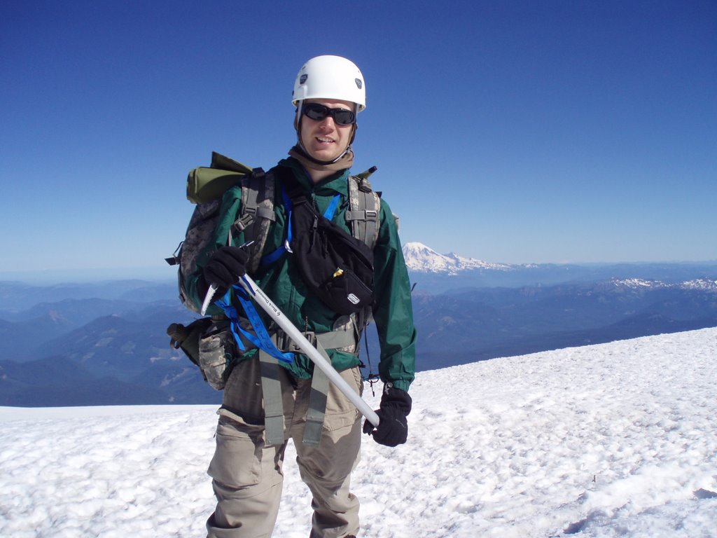
I was originally scheduled on in the class to climb Mt. Adams on July 22-23, two weeks after Mt. Baker. Because Ariele and I are moving into a new home that weekend, I was able to coordinate with the instructor to go with a different group and move it up a week. I wasn’t sure that I would be able to do this until 2 days before the climb, and I had a only 5 days to recover from the climb up Mt. Baker before climbing Adams. I thought that Mt Adams would be similar to in difficulty, but I was wrong. It turned out to be a much more difficult and challenging climb.

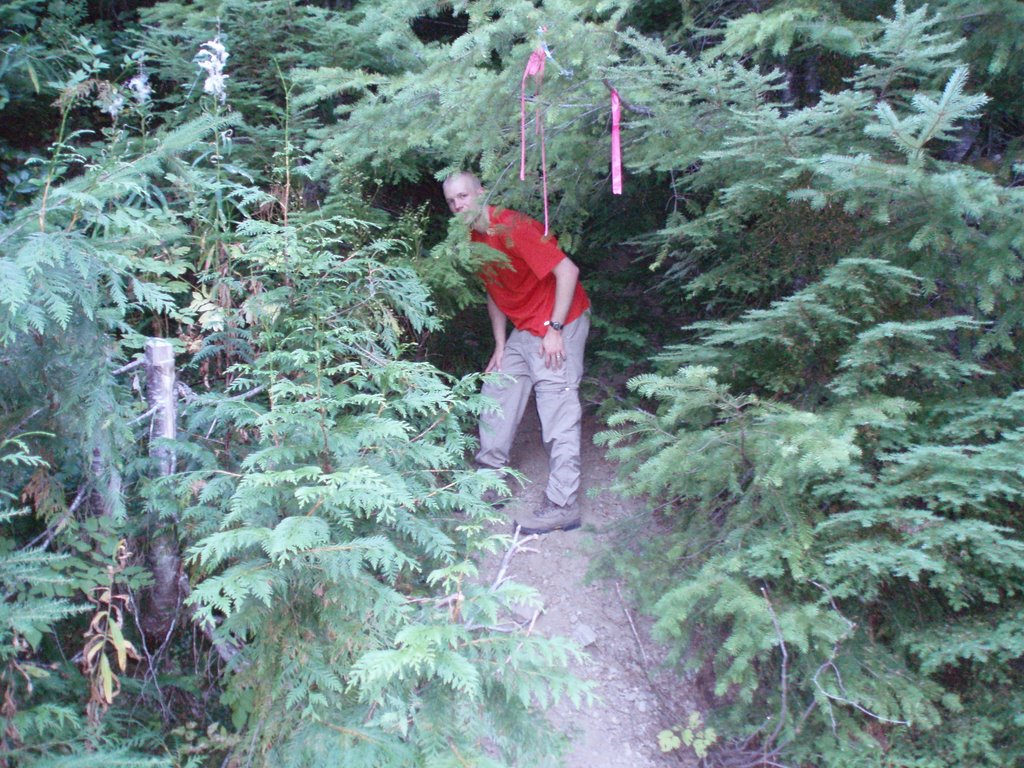
The weekend started Friday afternoon when Ken, Chris, Dan and Melissa picked me up at home we started the long drive down to Trout lake. The drive was a lot of fun, and I enjoyed the company. We stopped several times, including and stop for dinner in Cougar, WA. At the Washington-Oregon border, we turned east towards Mt. Adams. I had never been down that road before and it was a very scenic drive. We spent the night at a county park in Trout lake, WA and got to the trailhead at Bird Creek Meadows in the Yakima Indian Reservation first thing on Saturday morning.

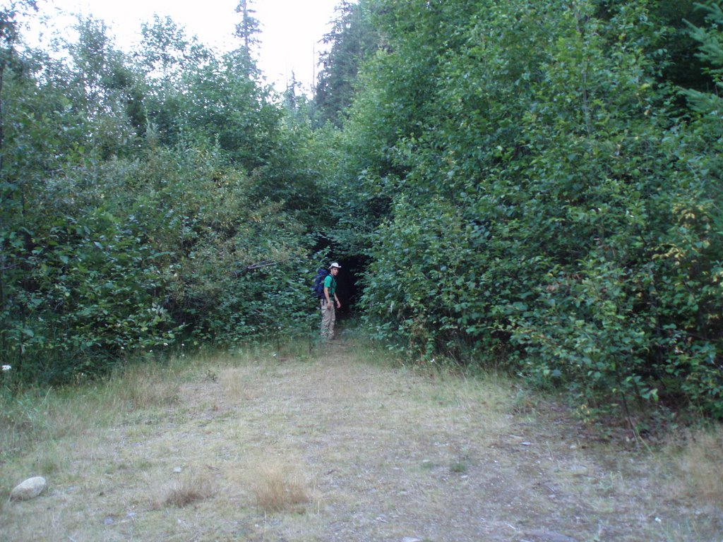
The first thing I noticed when I got to the trail head was the mosquitoes. They were so hungry they even bit through my shirt and ignored the bug repellent I put on. In fact the only thing the bug repellent did was mix with the sunscreen to create a sticky mess on my skin. After half an hour of prepping gear and ineffectually swatting mosquitoes our group of 10 climbers left the trailhead for Sunrise camp, at 8340’ on the southeast slope of Mt. Adams.

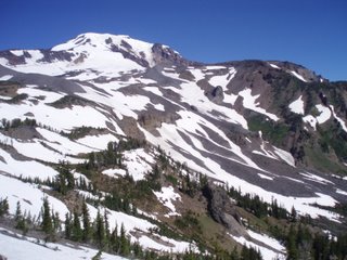
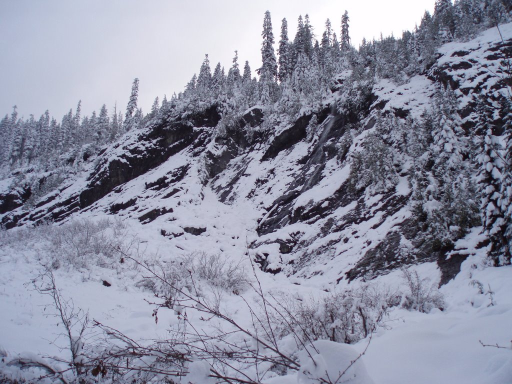
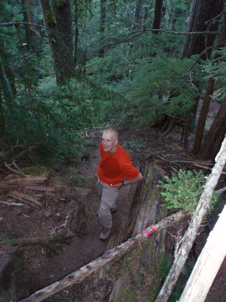
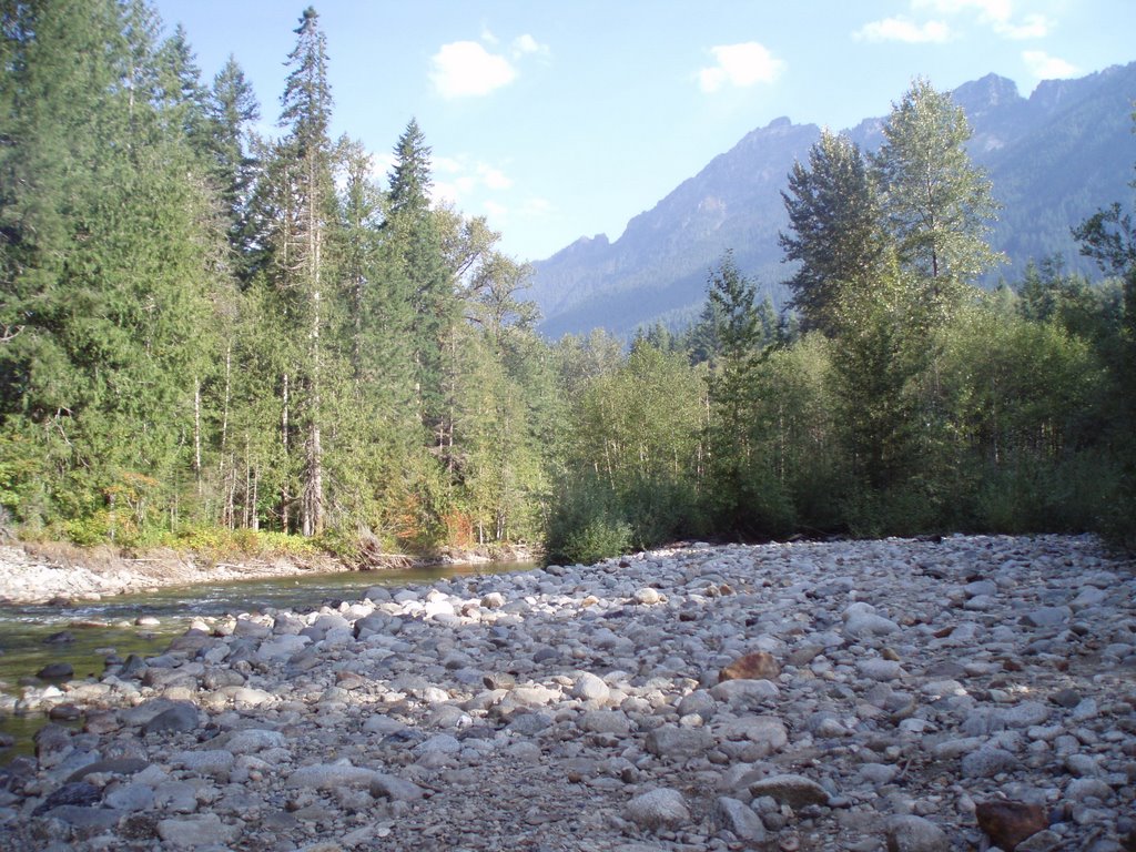
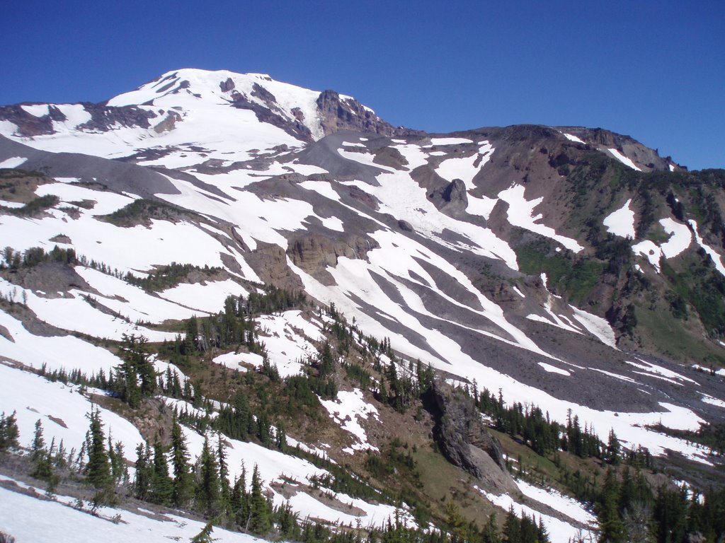
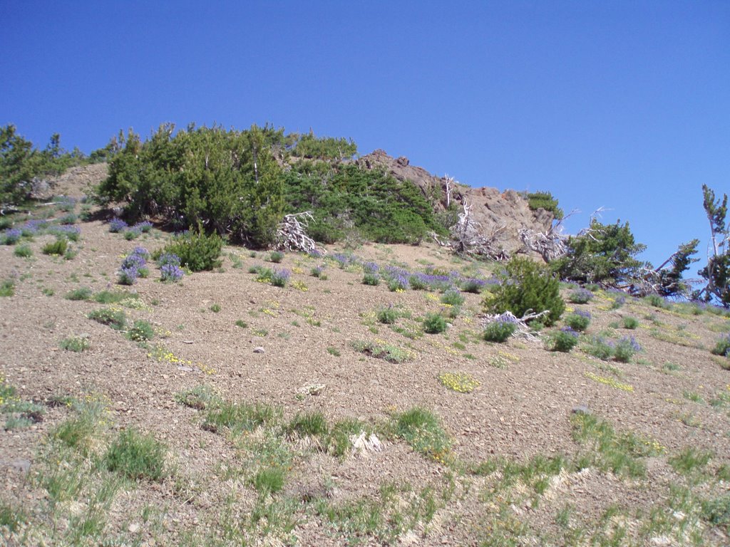
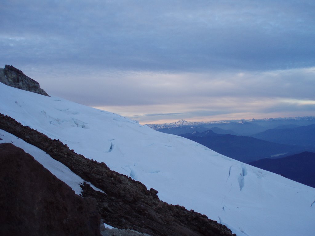
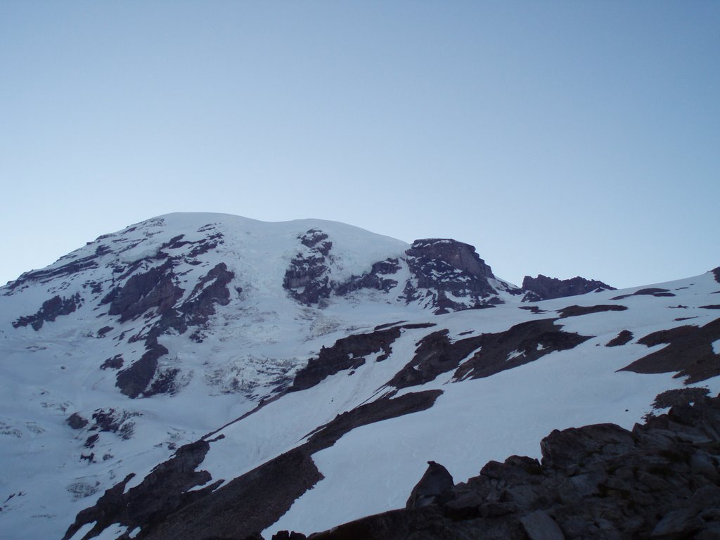
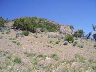
The hike in to high camp was only 3 miles, but it took jus five hours to get there. The trail was hard to follow, and there were several places where the trail disappeared in a maze of volcanic rocks. It was fascinating to do hike on the opposite end (NW vs. SE) on the WA cascades from Mt. Baker, and only a week later. There was very stark difference in the vegetation on the two mountains. Mt. Baker was very lush and green and covered in plants, while Mt. Adams seemed semi-arid and in many ways similar to mountains in CA. Both mountains were beautiful and I enjoyed every minute that I spent on them.

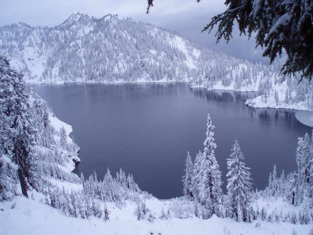
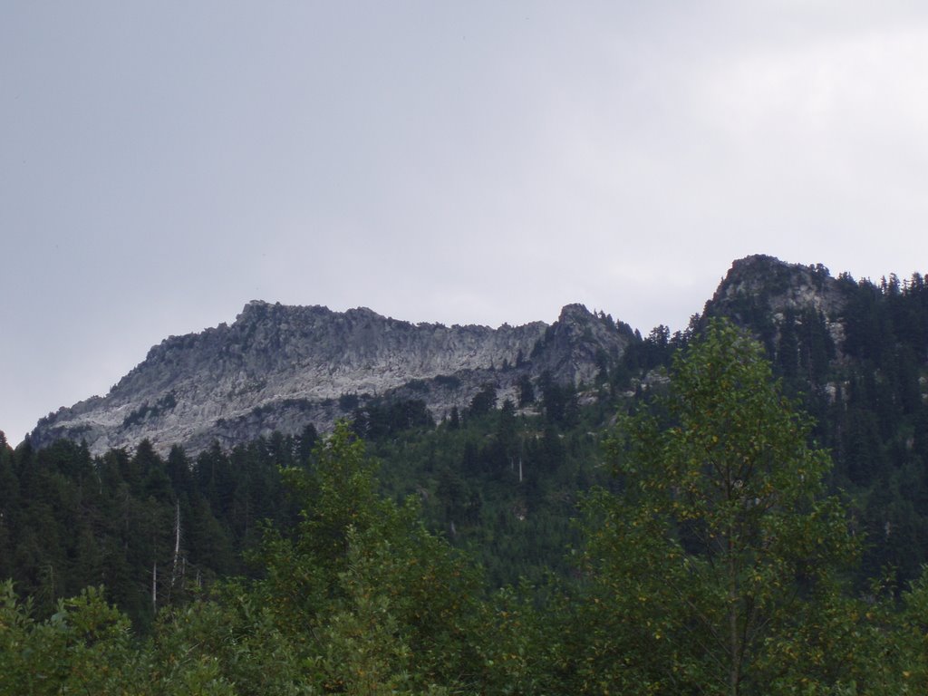
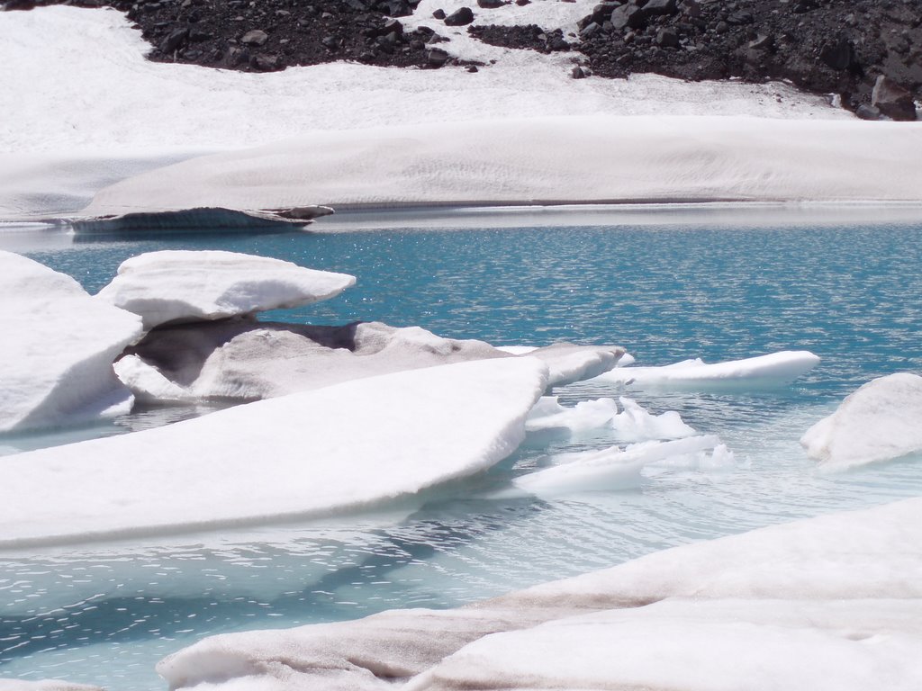
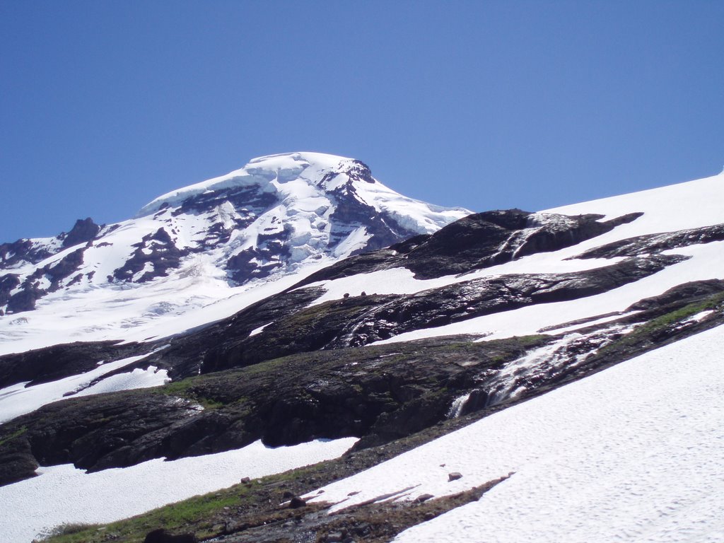
About an hour after leaving the tree line, our instructors lead us to a wonderful place to take a break for lunch. Inside a depression in the volcanic rocks was a small lake that had been frozen during the winter and even in July was still only partly thawed. It was as if we had walked into the artic in summer time. Several people went out onto the iceberg on the lake and got a better look at it, and then we moved on to high camp.

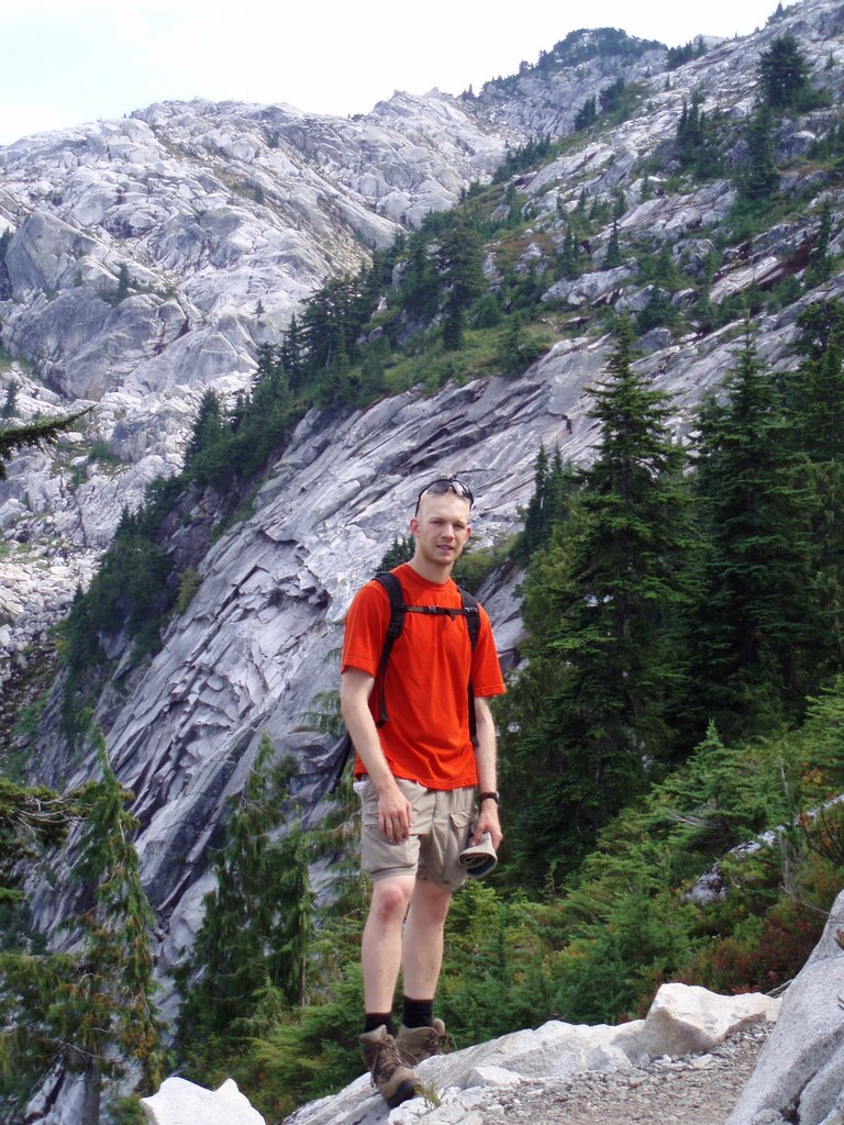
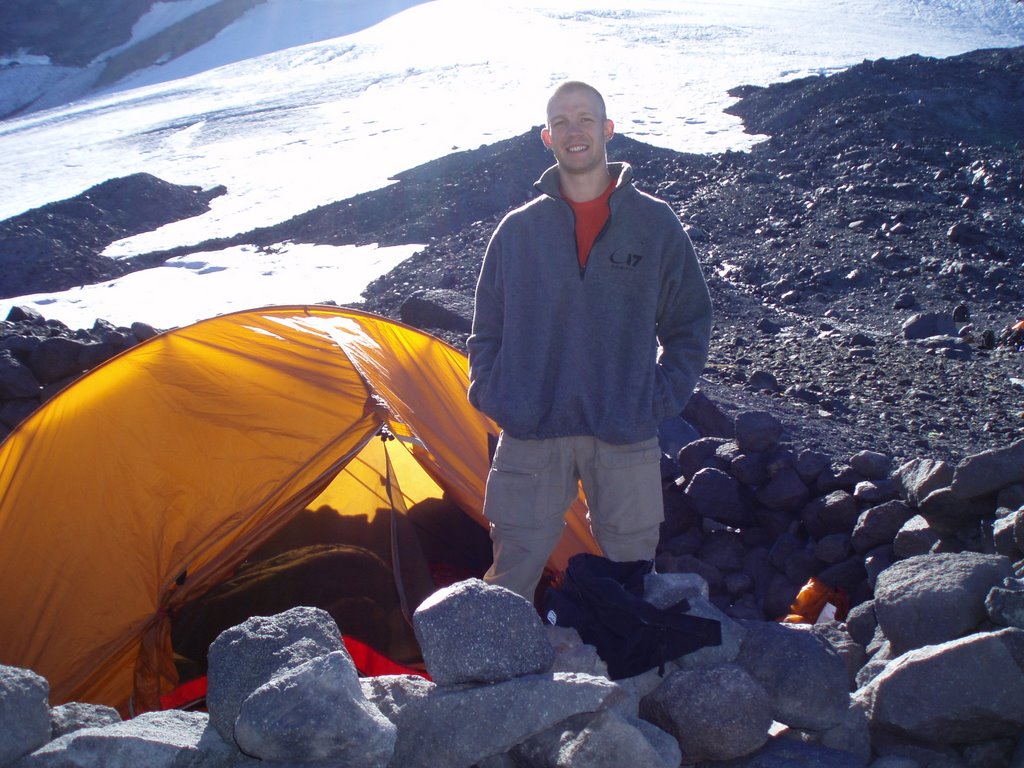
Saturday was a perfect day to spend at high camp. It was sunny, but not too hot, breezy, but not windy and high camp was open and snow free. After all the tents were set up, I went with three other people to sit in the shade and eat dinner. As we ate, we spotted a family of mountain goats nearby and watched them wander around the outskirts of our camp. When we returned we found that the rest of the group had put together a wildly entertaining game of Bocce rock. When the game was finished, we had a final briefing and everyone went back to their tents and went to sleep at around 7pm. I was alone in my tent because there was an odd number of people, and because of the breeze, I couldn’t sleep without earplugs.

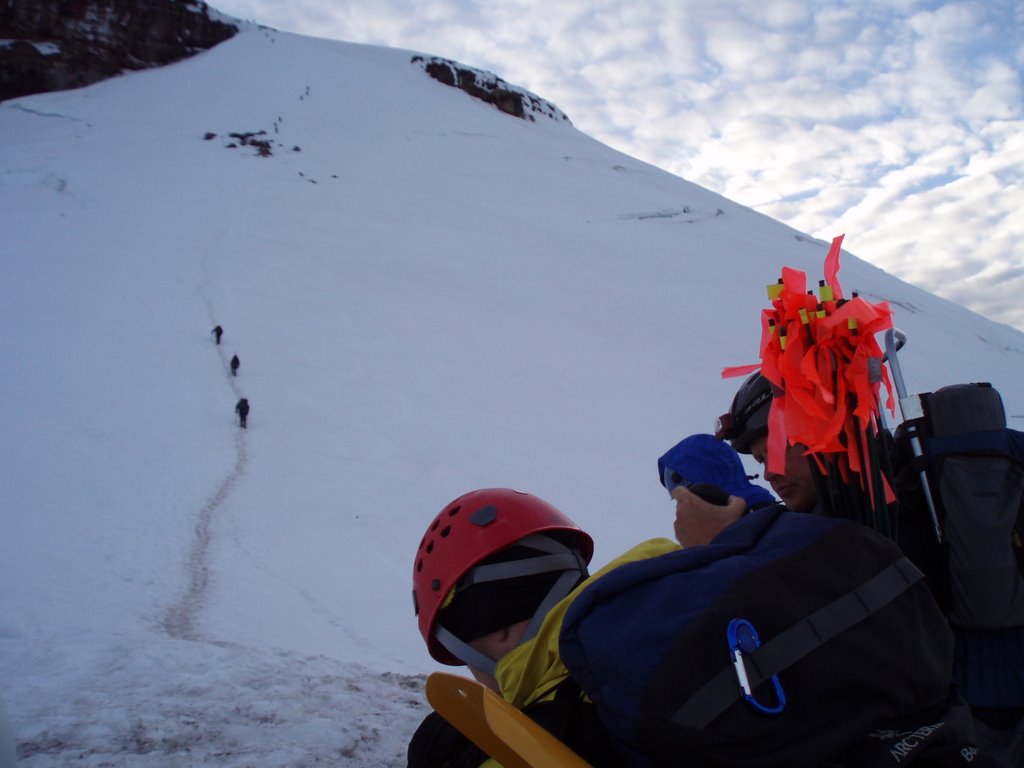
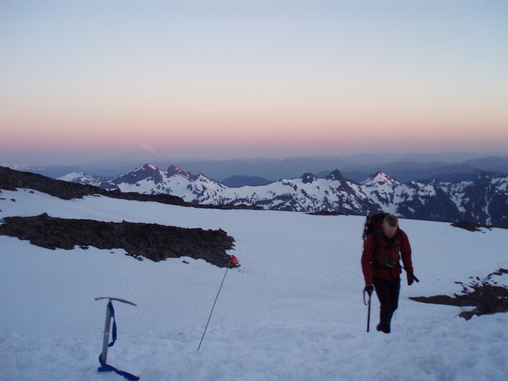
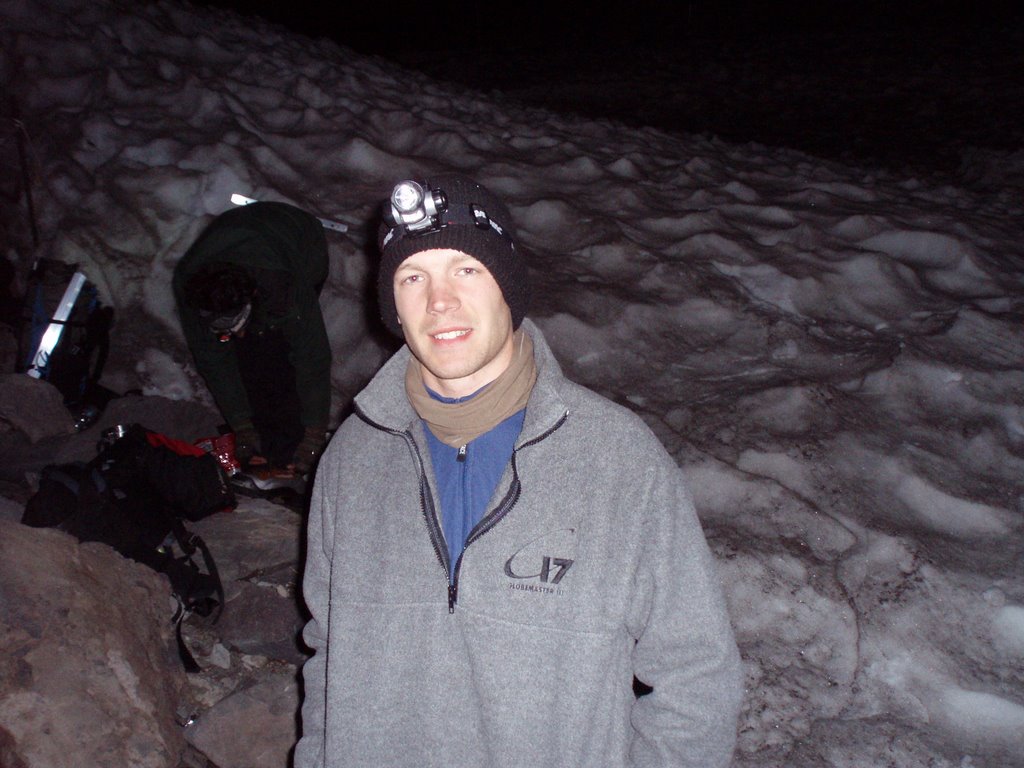
At 2am, Dan tried several times before waking me up, because of the earplugs I was wearing, and I scrambled to get ready to go before the 0230 deadline. It was surprisingly warm out for the mountain and time, so I was equally surprised to find that the snow had turned to ice and we needed to wear crampons. Putting on the crampons delayed our start until about 0300.

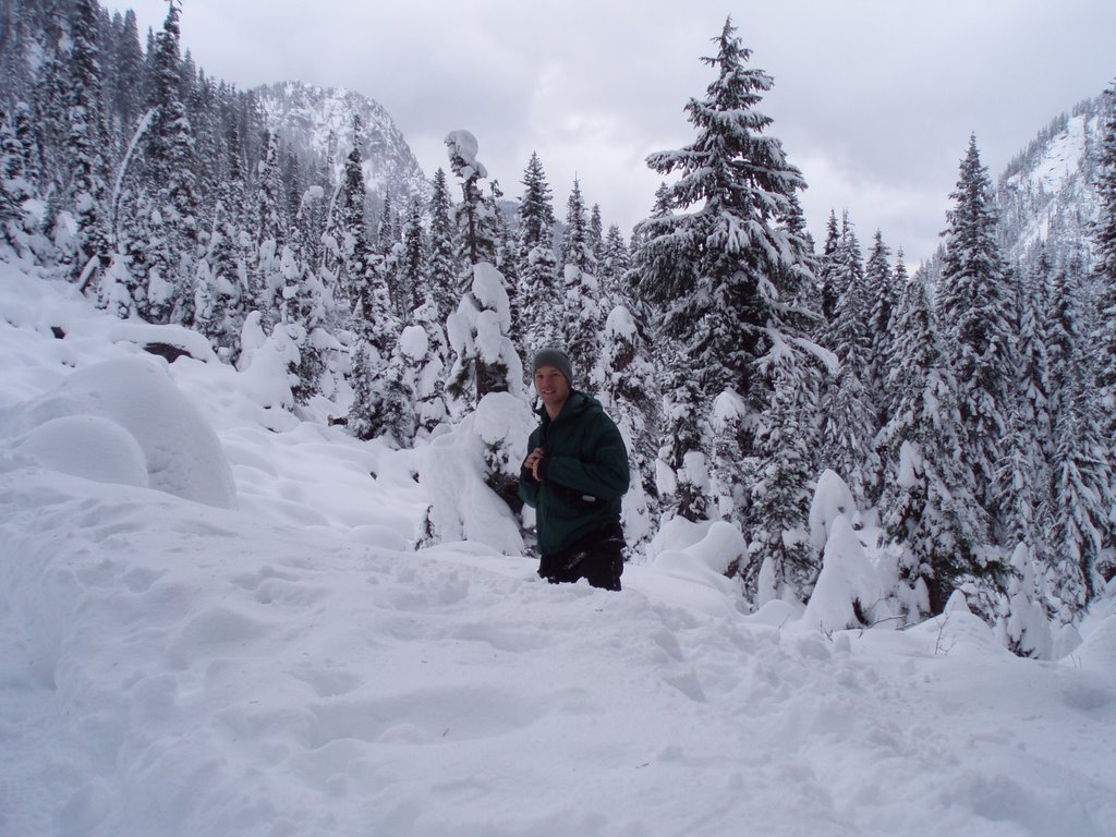
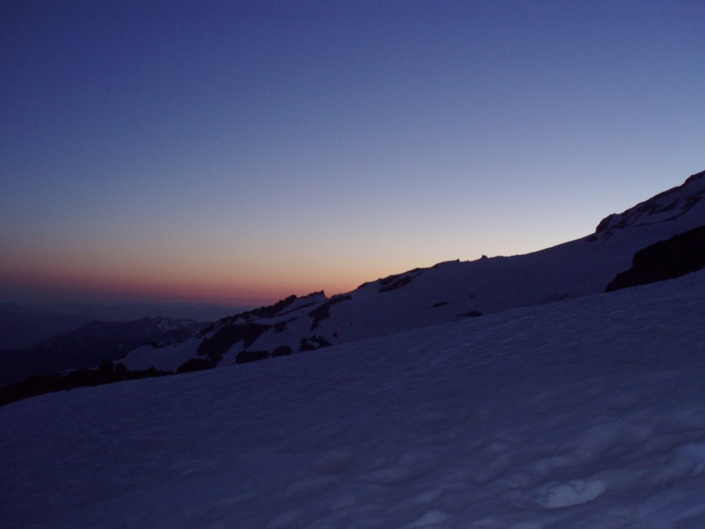
The glacier got right down to business and started steep and then got worse. I think the majority of our day’s climb was on slopes around 45 degrees. It took some time for me to get used to the exposure, and I was very scared of the height and the steepness for the first hour or more of the climb. I felt better I prayed about it and Ken reminded me that I wasn’t going anywhere. If I fell, the other two members of my rope team would keep me from falling far. Soon we started to see the light of the sunrise over the horizon. It was stunningly beautiful, and the many colors reminded me of my wife and her closet. I saw all the colors of the rainbow on the horizon, with red at the bottom, and blue and purple in the sky that was still mostly dark.

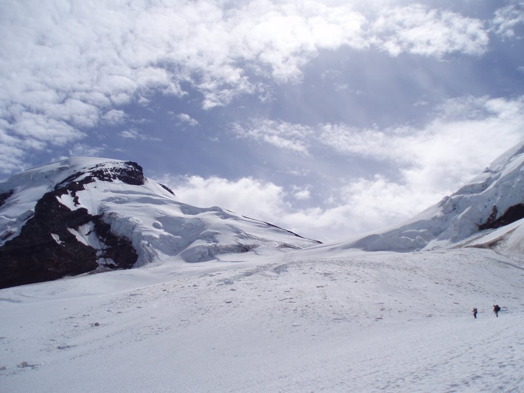
After 3 or 4 hours of climbing, we reached a small flat spot on the glacier and turned west to leave the glacier and cross over onto the south climb route. From there it was just a log snow slog up 2000’ to the summit of Mt. Adams. It was slow going, as we had been moving for 6 hours already, and the air is much thinner at 10,000’ and we had to breathe slowly and deeply to give our bodies enough air to not get sick.

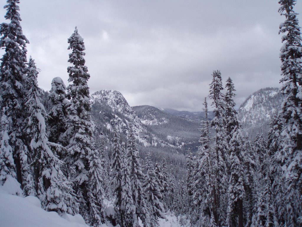
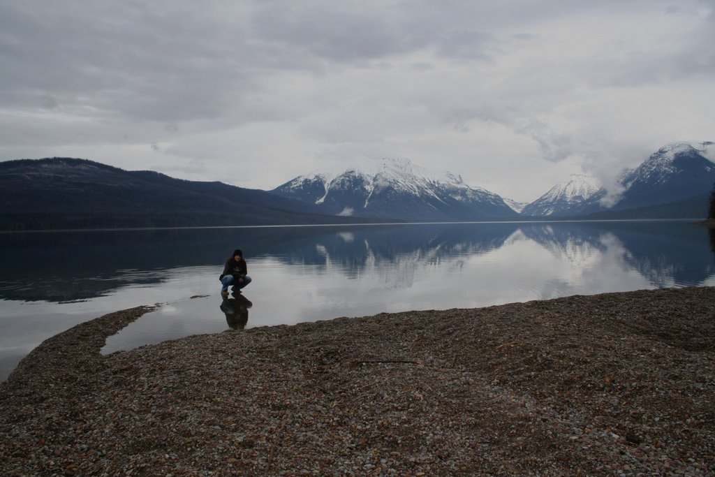
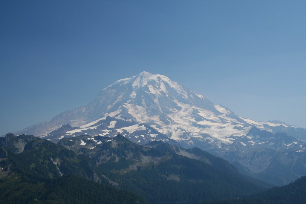
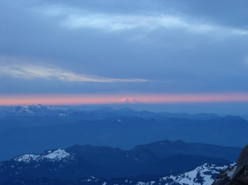
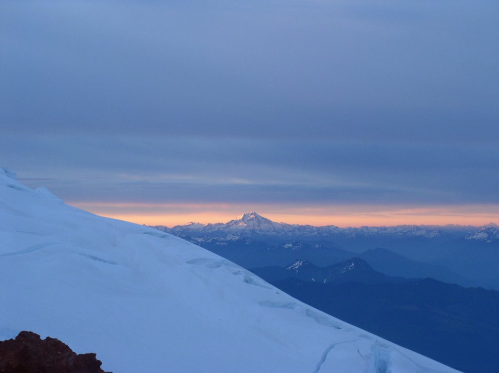
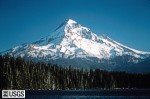
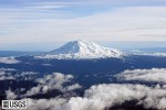
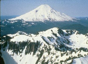
At 0930, after over 7 hours of climbing steep slopes, we reached the summit of Mt. Adams. The view was 
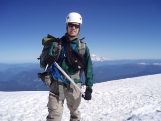
breathtaking. To the south were Mt. Hood, Mt. Jefferson, the Three Sisters, and then and fourth mountain range we could not identify. To the north were Mt. St. Helens, Mt. Rainier, and in the distance over 250 miles away, was Mt. Baker. It was cold, windy and high at the summit, so we stayed only long enough to take some pictures, have a snack and then head down.

It took us 4 hours to get back to high camp, and then another 4 hours to pack up and get back to the trail head. In all, on Sunday we spent 13 of 14 hours on our feet with packs on ours backs, climbed 4,000’ and then descended 7,000. It was a long day. Despite being much more challenging, I felt much better after Adams than after Baker, and I was sore only 2 days instead of 4. It was an awesome climb, but I don’t think it is one that I will repeat again soon. With this climb, my class is now over, except for the picture party next month. I will miss it very much, and hope that it is not too long before I can find someone to climb with again.

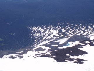
I would like to thank God for not letting me die, and helping me get deal with my fear of heights. Also to my wife for supporting me taking this class and climb, and letting me use her equipment that helped me a lot on Mt. Adams.


Wednesday, July 19, 2006

The History of Mt. Adams

The Creation of Mount Adams

The mountain as we see it today is the result of volcanic activity and the effects of glaciers on those volcanic deposits. The events listed below are among the most dramatic, but certainly not the only events responsible for the shape of Mount Adams as we know it today.

Avalanche on Mt. Adams.
Recent Avalanche on Mt. Adams (expanded image 1024 x 768 JPEG 99k) Photo by Jim Chamberlain

Among all the volcanic peaks in the Pacific Northwest, Mount Adams has a rich and varied history. Adams lacks the symmetry which often characterizes volcanic cones. Instead, it is a long ridge composed of a complex of several cones that grew from volcanic flows occurring over successive ages.

  • 450,000 years ago: oldest eruptions associated with Mount Adams.
  • 25,000 to 12,000 years ago: the period of most recent cone-building. The entire mountain above timberline was constructed in a series of eruptions issuing at the true summit, south summit and Suksdorf Ridge.
  • 21,000 to 12,000 years ago: the last major glacial expansion when ice covered virtually the entire Wilderness. Tongues of glacial ice extended well down many of the surrounding valleys. The glaciers smoothed and streamlined formerly rough lava surfaces. These surfaces are now covered by deep glacial deposits or more recent lava flows. The road to Morrison Creek and Cold Springs ascends one of these glacier-formed ridges (also called moraines).
  • 5,100 years ago: the Pinnacle was formed by a great avalanche. Sulfur gases (mostly hydrogen sulfide) combining with melt water from the ice cap created sulfuric acid. This acidic melt water flowing from the summit, severely weakened the summit rocks resulting in a dramatic avalanche. Debris from this avalanche flowed down the White Salmon River to the Trout Lake Valley. The many large yellow-brown boulders around the valley are conspicuous reminders of this great avalanche.
  • 3,500 to 6,000 years ago: the Muddy Fork and Aiken Lava Flows moved down the flanks of Mount Adams, the latest, and probably not the last, volcanic activity of Mount Adams.
  • Twentieth century: In 1983 and 1921 large avalanches broke off the Avalanche and White Salmon Headwall, the same headwall created by the great avalanche 5,100 years ago.
  • The 1921 avalanche fell nearly one mile, covering almost 6,000 acres with debris. Other avalanche deposits are prominent at Devils Garden, Avalanche Valley, and along the Big Muddy below the Klickitat Glacier.

Other Things to Know

Glaciers on Mount Adams
Glaciers on Mount Adams. (expanded image 1024 x 768 JPEG 75k) Photo by Jim Chamberlain

Sheer size: Mount Adams, at 12,276 feet, is the second-highest peak in Washington state. Only Mount Rainier is taller. It is also the second-largest volcano in the continental US - twice the size of Mount Rainer!

For scale: the volume of volcanic materials that make up Mount Adams would fill a rectangle hole 15 miles long and 10 miles wide with almost a thousand feet of debris.

Human use in the Mount Adams area dates back 9,000 years. Numerous Indian tribes used the lands surrounding the mountain for berry picking, fishing, and permanent settlements. Written histories of these people were not make until after exploration by Lewis and Clark in 1805. In the 1890's C.E. Rusk documented encounters with Indians while hiking at timberline on Mount Adams.

Most mountain summits are the scene of only momentary visits, however Mount Adams has a history of human use that is varied and unusual. In 1921, the Forest Service completed construction of the highest fire lookout in the country. Due to the high elevation, heavy snows, and poor visibility, however, it was only staffed until 1924. Meanwhile, over 1,800 pounds of supplies were backpacked to the summit each season.

In 1929, Dean Wade and the Glacier Mining Co. filed a mining claim to obtain sulfur at the summit. Primarily a prospecting operation, the mine was most active from 1932 to 1936. The claim expired 1959. A trail suitable for horses and mules, was constructed to the summit. A total of 168 pack trains made the trip to the summit each year.

Significant Events

  • 7,000 B.C. - Evidence of human use in the vicinity of Mount Adams
  • 1805 A.D.- First sighting of Mount Adams by white explorers: Lewis and Clark expedition.
  • 1854 - First verified ascent by white men.
  • 1855 - Yakima Treaty defined the current Yakima Reservation including 14 tribes.
  • 1867 - The first recorded ascent by women
  • 1942 - Mount Adams Wild Area designated
  • 1964 - The Wilderness Act established the 36,356 acre Mount Adams Wilderness
  • 1972 - Tract D returned to Yakima Indian Reservation due to revised interpretation of the treaty.
  • 1980 - Eruption of Mount St. Helens: Mount Adams closed to the public.
  • 1984 - Wilderness expanded to the current size, 47,270 acres

What's in a name?

Mt. Adams Recreation Area
Mt. Adams Recreation Area (expanded image 640 x 480 JPEG 58k)

The naming of the peak the Indians called Pa-Toe has been a comedy of geographical errors. Due to its easterly location, the mountain was not sighted on Vancouver's exploration of the Northwest. Thus, when Lewis and Clark, who were relying on Vancouver's descriptions, saw it, they thought they were seeing Mount St. Helens. This was the first of many recorded misidentifications.

Both St. Helens and Hood got their "English" names long before Adams, whose name survives from an 1839 scheme by Hall J. Kelly to make the Cascades the Presidential Range. He was inspired, by Lewis and Clark's naming Mount Jefferson in Oregon after the president who supported their journey across the continent. Kelly, however, intended the name Adams to go to Mount Hood -- he left the mountain in Washington out of the plan entirely. And the person who mapped the mountains mixed up Kelly's names and also put the name Mount Adams 40 miles in the wrong direction -- where there happened to be a mountain ready to bear the name. The Native Americans, of course, knew it was there all along -- they called the mountain Pahtoe. "Mount Adams" stuck firmly after 1853, when the Pacific Railroad Expedition put the name on their map. As for the grand Presidential Range scheme, "very few of the names took."

Source: US Forest Service Website; www.fs.fed.us

Because of work, lack of sleep and the move, it will be a few days before I can post a trip report of my summit of Mt. Adams this week. Here is some History of the moutain that I found interesting.

Thursday, July 13, 2006

The Legend of Mt. Adams

Once there was a woman, who, because of her reputation for kindness and beauty was sought after by many men. The most famous of these were two young chiefs Wy'east from the land of the Mulnomahs and Pa-toe from the Klickitats.
Both fell in love with her, but she could not choose between them. The two young grew angry at her indecision and began to quarrel. Soon a fierce battle resulted. Villages and forests were destroyed by fire, great boulders were hurled and tossed about, devastating the land. The great Spirit, Sahale, frowned on the lovers and struck them down.
However, even as he chastised them, he wanted to show his love for them. So he reared a mighty mountain peak where each one fell. Because the woman was so beautiful, St. Helens (prior to the 1980 eruption) became a perfect symmetrical cone, dazzling white.
Young Wy'east, Mount Hood, lifts his head in pride, but Pa-toe, Mt. Adams, for all his rough ways had a tender heart and wept to see the beautiful maiden wrapped in snow. So it is that he hangs his head forever in sorrow as he gazes upon her beauty.


When I went white water rafting two weeks ago, I got my first good look and Adams and Hood, and was reminded of the legend. A little background on the mountain I will be climbing this weekend.


Source: US Forest Service Website
Top Photo: Mt. St. Helens (Loowit) prior to the 1980 eruption. Photo by USFS.
Bottom Left: Mt. Hood, Wy'East. Photo by USGS Cascade Volcano Observatory.
Bottom Right: Mt Adams, Pa'Toe.
Photo by USGS Cascade Volcano Observatory.

Wednesday, July 12, 2006

Mt. Baker, WA : First Volcano Summit


( Mt Baker from Heliotrope Ridge)
Last weekend I climbed Mt. Baker with my class from Pierce college. Mt. Baker is 10,778ft and located in the North Cascades just south of the canadian border. It is heavily glaciated and also the second most active volcano in Washington state.
The trip started as soon as I got off work of friday, when met up with mark and we braved traffic and 130 miles of I-5 to reach the mountain. We met our instructors Ken, Chris and Dan and had dinner in Bellingham and then we all spent the night at a campground near the foot of the mountain. We packed three cars into a one car campsite and set up our tents by headlights, but it was a good night. I splept well, and had plenty of time to get ready in the morning.
At 0900 on the 8th, our class met at the Heliotrope ridge trailhead at Mt. Baker and we headed out to the glacier. Even in the morning it was alreday too warm for me, and I glad when we started to get some cloud cover. After 2.5 miles and half a dozen stream crossings, we were at the foot fo the Coleman glacier and started to rope up. Much of the snow had melted out and there were waterfalls and streams of snowmelt everywhere. There were also several other rope teams on the same route, and so it took us a few hours to get to high camp. Just below high camp, there was an area in the glacier with dozens of crevasses, and so we went around it, and then set up 100m upslope from where everyone else had camped.
Once we got to high camp at around 1400, there was much to be done, and only a few hours before bedtime. We had several tents to set up, and then Dan and I sat down to eat dinner and melt snow. I amazed my civilian classmates with my MRE and it's food and water heating capabilites. Then there was some gear rearranging, more training and we went to bed at about 1900 with a view of the summit out the tent window.
At 0145 Dan woke me up. I wanted to sleep longer, but got up and got ready to go. At 0235 we were all roped in and left high camp bound for the summit. I was on the last spot on the second rope. The pace was easy, and I had enough time to look around as we climbed higher up the mountain. Down below I could see the lights of the city of Bellingham, and in the sky were shades of sunrise, even at 0300. We crossed several crevasses on the route, and had to jump over a few. The rest were small enough to just step over, or we went around them.
At around 0530 we reached a small platform of snow at the top of a steep slope and took a break. The view was breathtaking. On was side was the whole Puget sound region, including the Olympics, and the islands, and to the east and south thewhole cascade range was spread out before us, with the rising sun giving an orange hue to the all of the taller peaks in the range.


( Left: Part of the sunrise. It wwas better, but those pictures didn't come out for some reason. Right: The Roman Wall)
We stayed and took pictures for a few minutes as we each made it to the platform, and then coiled in the ropes and continued up some switchbacks on a rocky lava ridge until we reached the final stretch known as the Roman Wall. The wall was very steep, and every time I looked down I felt a little afraid, but the view was so amazing I couldn't help but look down and gape every chance that I got. Soon I was used to the view and was no longer afraid of the height.

(Me at the Summit)
After an hour of climbing the Roman wall, we reached the pleateu, coiled in our ropes, and walked across to the small hill that was the true summit. There was a small metal box that had been there for ages and I signed the summit register that was inside. It was quite windy at the top, so we stayed only long enough to take pictures, and get some food and drink for the trip down. Since Mt. Baker is an active volcano, we could smell the sulfur at the top. It took five hours to reach high camp from the summit, and going down the roman wall was even more tiring that going up it. I fell a few times, but my trusty ice ax always kept me from going far.
It turned out that our timing was perfect. By the time we had returned to high camp and large lenticular cloud had descended on the summit, and we could tell that the conditions were white out and miserable up there. An hour later it started to rain on us in the valley.

(Mt. Baker from the Coleman Glacier)
The rest of the trip was uneventful, except that the descent was much longer and more tiring than I had anticipated. It is now three days since the trip and my legs are a little sore. I am sure they will heal in time for a trip up the Mazama glacier on Mt. Adams in 3 days.

Thursday, July 06, 2006

Artillery makes everything better

Went to a 4th of July fireworks show last night. Saw the 1812 overture performed with a live band and real cannons. Tsaichovsky (spelling?) is the only composer I know to write for orchestra and artillery. Very skilled. It was great, but they did the best part of the show first.

Leaving on friday to summit Mt. Baker with my class. Trip report and pictures to follow when I find time.

Tuesday, July 04, 2006

Weekend Fun

On Sunday Mary, Jacob, Ariele and headed down to the white salmon river in southern washington for a morning of white water rafting. It was my third time rafting, but it's always a lot of fun. Mary and Jacob had never been before and I hope they enjoyed it. We got lucky and it was only the four of us in our raft, and we had a great guide. The water was very cold, but paddling and a wet suit kept me warm and the river was beautiful. The highlight of our trip happened just after the start in some rapids called corkscrew. Jacob and I were in the front of the raft and Ariele and Mary were in the row behind us. Everything seemed to happen in slow motion as I watched the dip in the water come up and then a shock as I was chest deep as the raft went in. The raft came back out of the water and I was still sitting on the side of the raft, but leaning out on my back. I sat up and turned around and saw that our guide and I were the only ones who had not been thrown out. Our guide came up next to me and started to pull Jacob back in. I tried to help but realized I wasn't needed, so I went around him and pulled Ariele in. Her paddle got stuck on something and by the time she was in, the guide had pulled Mary back in, and we rushed back to our spots and grabbed paddle to negotiate the rest of that section of rapids. Someone's paddle (we don't know whose) fell out of the boat, so Mary gave me hers and in another minutes we were out and pulled to the side of the river. Another raft grapped our paddle, and we rested a few minutes before continuing our trip. In all, we travelled nine miles on the river in about three hours.

Check back later to see the pictures.

Friday, June 30, 2006

It's the weekend!!

After many days of anxious waiting, the weekend is here! I started my new job this week, and I like it a lot. My coworkers here are much more supportive and esaier to work with. I like being away from the company headquarters and being where things are happening. Unfortunately, the weather has been hot, but at least its been clear. I'm now off until the 5th of July, 5 days in a row. Sometime this weekend I'll find my way outdoors. Even though I love my new job, I'm praying that I will be able to get into an even better one, and I will work more towards that next week.

Sunday, June 25, 2006

It's Even Cooler At Night...


Even as far north as Washington, I'm not a summer person. As I learn more about mountaineering and winter travel, I become even less of a summer person. Sure, I like the clear skies and warm weather, but it starts to get annoying above 70 degrees, and I hate sunscreen and sunburns. It's even worse on glaciers and in the high country. It's too hot already, and then all the sun reflects back off the snow to make it miserably hot up high in the day time. So, Josh and I decided to climb to camp Muir at night. We also wanted a good taste of what a real summit attempt would be like, because all summit attempts should start at night.

We got to Paradise at about 6:30pm, geared up and headed out. We ran into a few people coming down, but no one else was going up. The snow was firm, but it was very rough. It was like walking on a beach, but sometimes the bumps in the snow would give, and sometimes they wouldn't. After about a mile we came to a long steep slope the led up to panorama point, and stopped to put on our crampons so that we could have better traction going. It was a long steep slope, but little did I know it was to be one of the easiest hills I climbed that night. Once at the top, we stopped at panorama point to take some picture and take off our crampons. Then we followed the dirt trail to pebble creek and stopped to fill our water bottles. The pure glacier melt water tasted a lot better than Lakewood tap water.

We started up the mountain again and up the never ending slope towards Camp Muir. I started out too fast, and soon my thighs started burning. After a while we stopped to rest at some rocks. A few minutes later we met a climbing ranger who was on his way down. He stopped to talk to us for a few minutes and I asked him what the conditions were like. He had an altimeter and told us that we were at about 8,000ft and so we have 2,100 feet about two hours to go. It was a little after 10pm. I stretched, drank some water and had a snack, and took some pictures and was ready to go again. After what seemed like half an hour Josh pointed out a ridge running across our path and said that once we go to the top of it, we would be able to see Camp Muir. This was encouraging because My thighs were really starting to hurt. Josh started to lead and kick steps, which helped and gave my thighs a chance to rest and recover.

I didn't bring a watch on the trip, so I had little sense of time, but occasionally I asked Josh about the time. The sunset was beautiful and since we were so high up, there was light on the western sky even until 11pm or after. From Panorama point until it was completely dark every time I turned around, I could see Mt. Adams, Mt. St. Helens, Mt Hood and every mountain in between. It was an awesome sight to see the sunset cast shadows and leave a reddish orange hue around these mountains. At one point I turned around to see that the sun had set but was still shining at the top of Mt. Adams, which lit up the summit compared to the surrounding area.

Once it was completely dark we stopped to put on our headlamps as we passed a party in the tents off to our right. They had camped a good distance below Muir and were up and about melting snow. I don’t know where they went because we never saw their headlamps coming up after us. I was again encouraged because I knew that people camping meant we were getting close to our destination. I was feeling ok, but starting to feel the 9,000 ft elevation. The slope seemed to just go on forever. Sometimes it was not so steep, but we were always going uphill. We could only the dark outline of the mountain and the small circle of snow lit up by our headlamps. It reminded me of documentaries I have watched about exploring the ocean floor. At about midnight I could see lights in the distance and wasn’t sure if they were at Muir or further up, but I knew we were close. I kept trudging forward, concentrating on my breathing my steps, and then a while later I looked up and I could see lights coming from the windows of the shelter and headlamps moving around. I picked up the pace and soon I could smell the outhouse, and then were there; Camp Muir, 10,188 ft. I put on some warm clothes and ate part of an MRE. We sat for about 15 minutes and watched the RMI groups getting ready to go. We both wished we could go with them, because it would be a perfect day to summit. Someday I’ll climb Rainier.

Below camp Muir, the snow was hard and mostly frozen. It was difficult to go down because it was too bumpy it most places to glissade, but the snow was so hard that I couldn’t really get my heels to bite into it. As we descended, the snow softened up, and we made excellent time downhill. Whenever we needed to check to make sure we were still on route, we would turn off our headlamps, and the starlight was bright enough to illuminate most of the terrain features.

At one point about halfway down the Muir snowfield we Josh stopped, turned off his headlamp and sat down. I did the same and we spent some time relaxing and looking around. Never before in my life have I seen such a breath taking display of stars. There were a few lights at Paradise, and across the valley I could see the starlight reflecting off the snow off the Tattoosh range. In the distance I could see the outline of High Rock, there was a dark shadow were Mt. Adams was, and I could see light on the horizon from Portland or Kelso. Behind us there I could glowing lines where groups of climbers were halfway to the summit. It was indescribably peaceful, and I think that even more than actually reaching the Camp, this was my favorite part of the trip.

An hour later we were back in the parking lot at paradise after 8 hours on the mountain. We packed up and headed home, and I stopped at the first gas station to buy some Hot Tamales to keep me awake. By the time we were home it was 5:30am and completely light outside. I went to sleep and woke up a 11am, have no memory at all of Ariele’s alarm going off and her leaving for church.

It was a painful and awesome experience. My legs will be sore for a few days, but they will be stronger because of it. I enjoyed the hike and am glad that Josh kept me going up. Now I want to see Muir in the day light. I can’t until until my next trip to the mountains. July 7-8 I will be summiting Mt. Baker, 10,778 ft with my climbing class. Two weeks later, Mt Adams, 12,276 ft. Someday I will climb Mt. Rainier.