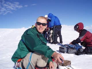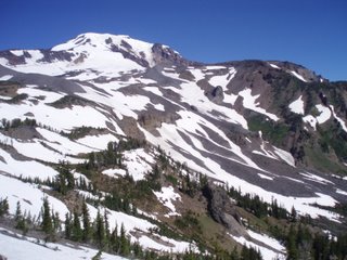
Sunday, July 30, 2006
New Place
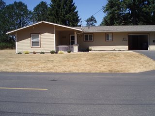
Moved into a new place last weekend. I really like it. It's really close to work, so I can spend a lot more time at home if I want to. I want to eventually ride my bike or run to work. I jsut bought the bike this morning. It's been over 10 years since I've owned a bike but just like they say, you never forget. We have a 3 bedroom 2 bathroom duplex, but only the grage touches the neighbors, so we never even know they are there. It's only a one car garage, but I there is a room inthe back corner for all my gear. I really like having all that space for it. we have a master suite with a large bedroom and a walk in closet. We set the smallest bedroom up as a guest room, so we have room for visistors to stay with us.
This morning I went on an everything must go cleaning rampage. I ran out of time, so not everything that needs to go is gone. Maybe tomorrow. We're not completely unpacked yet, and I'm tired of living with boxes.
Friday, July 28, 2006
Word Verification
Thursday, July 20, 2006
Mt. Adams Trip Report
I was originally scheduled on in the class to climb
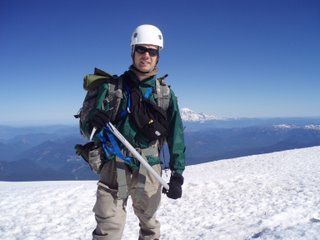
The weekend started Friday afternoon when Ken, Chris, Dan and Melissa picked me up at home we started the long drive down to Trout lake. The drive was a lot of fun, and I enjoyed the company. We stopped several times, including and stop for dinner in Cougar, WA. At the Washington-Oregon border, we turned east towards
The first thing I noticed when I got to the trail head was the mosquitoes. They were so hungry they even bit through my shirt and ignored the bug repellent I put on. In fact the only thing the bug repellent did was mix with the sunscreen to create a sticky mess on my skin. After half an hour of prepping gear and ineffectually swatting mosquitoes our group of 10 climbers left the trailhead for Sunrise camp, at 8340’ on the southeast slope of Mt. Adams.
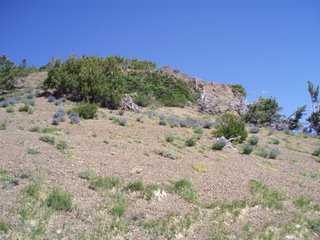
The hike in to high camp was only 3 miles, but it took jus five hours to get there. The trail was hard to follow, and there were several places where the trail disappeared in a maze of volcanic rocks. It was fascinating to do hike on the opposite end (NW vs. SE) on the WA cascades from
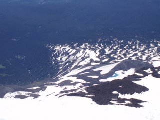
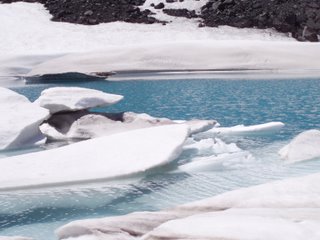
About an hour after leaving the tree line, our instructors lead us to a wonderful place to take a break for lunch. Inside a depression in the volcanic rocks was a small lake that had been frozen during the winter and even in July was still only partly thawed. It was as if we had walked into the artic in summer time. Several people went out onto the iceberg on the lake and got a better look at it, and then we moved on to high camp.
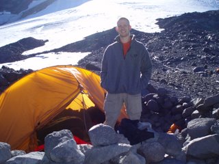
Saturday was a perfect day to spend at high camp. It was sunny, but not too hot, breezy, but not windy and high camp was open and snow free. After all the tents were set up, I went with three other people to sit in the shade and eat dinner. As we ate, we spotted a family of mountain goats nearby and watched them wander around the outskirts of our camp. When we returned we found that the rest of the group had put together a wildly entertaining game of Bocce rock. When the game was finished, we had a final briefing and everyone went back to their tents and went to sleep at around 7pm. I was alone in my tent because there was an odd number of people, and because of the breeze, I couldn’t sleep without earplugs.
At 2am, Dan tried several times before waking me up, because of the earplugs I was wearing, and I scrambled to get ready to go before the 0230 deadline. It was surprisingly warm out for the mountain and time, so I was equally surprised to find that the snow had turned to ice and we needed to wear crampons. Putting on the crampons delayed our start until about 0300.
The glacier got right down to business and started steep and then got worse. I think the majority of our day’s climb was on slopes around 45 degrees. It took some time for me to get used to the exposure, and I was very scared of the height and the steepness for the first hour or more of the climb. I felt better I prayed about it and Ken reminded me that I wasn’t going anywhere. If I fell, the other two members of my rope team would keep me from falling far. Soon we started to see the light of the sunrise over the horizon. It was stunningly beautiful, and the many colors reminded me of my wife and her closet. I saw all the colors of the rainbow on the horizon, with red at the bottom, and blue and purple in the sky that was still mostly dark.
After 3 or 4 hours of climbing, we reached a small flat spot on the glacier and turned west to leave the glacier and cross over onto the south climb route. From there it was just a log snow slog up 2000’ to the summit of
At 0930, after over 7 hours of climbing steep slopes, we reached the summit of
It took us 4 hours to get back to high camp, and then another 4 hours to pack up and get back to the trail head. In all, on Sunday we spent 13 of 14 hours on our feet with packs on ours backs, climbed 4,000’ and then descended 7,000. It was a long day. Despite being much more challenging, I felt much better after
I would like to thank God for not letting me die, and helping me get deal with my fear of heights. Also to my wife for supporting me taking this class and climb, and letting me use her equipment that helped me a lot on
Wednesday, July 19, 2006
The History of Mt. Adams
The Creation of Mount Adams
The mountain as we see it today is the result of volcanic activity and the effects of glaciers on those volcanic deposits. The events listed below are among the most dramatic, but certainly not the only events responsible for the shape of Mount Adams as we know it today.
Recent Avalanche on Mt. Adams (expanded image 1024 x 768 JPEG 99k) Photo by Jim Chamberlain |
Among all the volcanic peaks in the Pacific Northwest, Mount Adams has a rich and varied history. Adams lacks the symmetry which often characterizes volcanic cones. Instead, it is a long ridge composed of a complex of several cones that grew from volcanic flows occurring over successive ages.
- 450,000 years ago: oldest eruptions associated with Mount Adams.
- 25,000 to 12,000 years ago: the period of most recent cone-building. The entire mountain above timberline was constructed in a series of eruptions issuing at the true summit, south summit and Suksdorf Ridge.
- 21,000 to 12,000 years ago: the last major glacial expansion when ice covered virtually the entire Wilderness. Tongues of glacial ice extended well down many of the surrounding valleys. The glaciers smoothed and streamlined formerly rough lava surfaces. These surfaces are now covered by deep glacial deposits or more recent lava flows. The road to Morrison Creek and Cold Springs ascends one of these glacier-formed ridges (also called moraines).
- 5,100 years ago: the Pinnacle was formed by a great avalanche. Sulfur gases (mostly hydrogen sulfide) combining with melt water from the ice cap created sulfuric acid. This acidic melt water flowing from the summit, severely weakened the summit rocks resulting in a dramatic avalanche. Debris from this avalanche flowed down the White Salmon River to the Trout Lake Valley. The many large yellow-brown boulders around the valley are conspicuous reminders of this great avalanche.
- 3,500 to 6,000 years ago: the Muddy Fork and Aiken Lava Flows moved down the flanks of Mount Adams, the latest, and probably not the last, volcanic activity of Mount Adams.
- Twentieth century: In 1983 and 1921 large avalanches broke off the Avalanche and White Salmon Headwall, the same headwall created by the great avalanche 5,100 years ago.
- The 1921 avalanche fell nearly one mile, covering almost 6,000 acres with debris. Other avalanche deposits are prominent at Devils Garden, Avalanche Valley, and along the Big Muddy below the Klickitat Glacier.
Other Things to Know
Glaciers on Mount Adams. (expanded image 1024 x 768 JPEG 75k) Photo by Jim Chamberlain |
Sheer size: Mount Adams, at 12,276 feet, is the second-highest peak in Washington state. Only Mount Rainier is taller. It is also the second-largest volcano in the continental US - twice the size of Mount Rainer!
For scale: the volume of volcanic materials that make up Mount Adams would fill a rectangle hole 15 miles long and 10 miles wide with almost a thousand feet of debris.
Human use in the Mount Adams area dates back 9,000 years. Numerous Indian tribes used the lands surrounding the mountain for berry picking, fishing, and permanent settlements. Written histories of these people were not make until after exploration by Lewis and Clark in 1805. In the 1890's C.E. Rusk documented encounters with Indians while hiking at timberline on Mount Adams.
Most mountain summits are the scene of only momentary visits, however Mount Adams has a history of human use that is varied and unusual. In 1921, the Forest Service completed construction of the highest fire lookout in the country. Due to the high elevation, heavy snows, and poor visibility, however, it was only staffed until 1924. Meanwhile, over 1,800 pounds of supplies were backpacked to the summit each season.
In 1929, Dean Wade and the Glacier Mining Co. filed a mining claim to obtain sulfur at the summit. Primarily a prospecting operation, the mine was most active from 1932 to 1936. The claim expired 1959. A trail suitable for horses and mules, was constructed to the summit. A total of 168 pack trains made the trip to the summit each year.
Significant Events
- 7,000 B.C. - Evidence of human use in the vicinity of Mount Adams
- 1805 A.D.- First sighting of Mount Adams by white explorers: Lewis and Clark expedition.
- 1854 - First verified ascent by white men.
- 1855 - Yakima Treaty defined the current Yakima Reservation including 14 tribes.
- 1867 - The first recorded ascent by women
- 1942 - Mount Adams Wild Area designated
- 1964 - The Wilderness Act established the 36,356 acre Mount Adams Wilderness
- 1972 - Tract D returned to Yakima Indian Reservation due to revised interpretation of the treaty.
- 1980 - Eruption of Mount St. Helens: Mount Adams closed to the public.
- 1984 - Wilderness expanded to the current size, 47,270 acres
What's in a name?
Mt. Adams Recreation Area (expanded image 640 x 480 JPEG 58k) |
The naming of the peak the Indians called Pa-Toe has been a comedy of geographical errors. Due to its easterly location, the mountain was not sighted on Vancouver's exploration of the Northwest. Thus, when Lewis and Clark, who were relying on Vancouver's descriptions, saw it, they thought they were seeing Mount St. Helens. This was the first of many recorded misidentifications.
Both St. Helens and Hood got their "English" names long before Adams, whose name survives from an 1839 scheme by Hall J. Kelly to make the Cascades the Presidential Range. He was inspired, by Lewis and Clark's naming Mount Jefferson in Oregon after the president who supported their journey across the continent. Kelly, however, intended the name Adams to go to Mount Hood -- he left the mountain in Washington out of the plan entirely. And the person who mapped the mountains mixed up Kelly's names and also put the name Mount Adams 40 miles in the wrong direction -- where there happened to be a mountain ready to bear the name. The Native Americans, of course, knew it was there all along -- they called the mountain Pahtoe. "Mount Adams" stuck firmly after 1853, when the Pacific Railroad Expedition put the name on their map. As for the grand Presidential Range scheme, "very few of the names took."
Source: US Forest Service Website; www.fs.fed.us
Because of work, lack of sleep and the move, it will be a few days before I can post a trip report of my summit of Mt. Adams this week. Here is some History of the moutain that I found interesting.Thursday, July 13, 2006
The Legend of Mt. Adams
Both fell in love with her, but she could not choose between them. The two young grew angry at her indecision and began to quarrel. Soon a fierce battle resulted. Villages and forests were destroyed by fire, great boulders were hurled and tossed about, devastating the land. The great Spirit, Sahale, frowned on the lovers and struck them down.
However, even as he chastised them, he wanted to show his love for them. So he reared a mighty mountain peak where each one fell. Because the woman was so beautiful, St. Helens (prior to the 1980 eruption) became a perfect symmetrical cone, dazzling white.
Young Wy'east, Mount Hood, lifts his head in pride, but Pa-toe, Mt. Adams, for all his rough ways had a tender heart and wept to see the beautiful maiden wrapped in snow. So it is that he hangs his head forever in sorrow as he gazes upon her beauty.
When I went white water rafting two weeks ago, I got my first good look and Adams and Hood, and was reminded of the legend. A little background on the mountain I will be climbing this weekend.
Source: US Forest Service Website
Top Photo: Mt. St. Helens (Loowit) prior to the 1980 eruption. Photo by USFS.
Bottom Left: Mt. Hood, Wy'East. Photo by USGS Cascade Volcano Observatory.
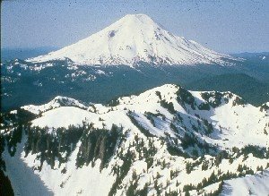
Bottom Right: Mt Adams, Pa'Toe. Photo by USGS Cascade Volcano Observatory.
Wednesday, July 12, 2006
Mt. Baker, WA : First Volcano Summit
The trip started as soon as I got off work of friday, when met up with mark and we braved traffic and 130 miles of I-5 to reach the mountain. We met our instructors Ken, Chris and Dan and had dinner in Bellingham and then we all spent the night at a campground near the foot of the mountain. We packed three cars into a one car campsite and set up our tents by headlights, but it was a good night. I splept well, and had plenty of time to get ready in the morning.
At 0900 on the 8th, our class met at the Heliotrope ridge trailhead at Mt. Baker and we headed out to the glacier. Even in the morning it was alreday too warm for me, and I glad when we started to get some cloud cover. After 2.5 miles and half a dozen stream crossings, we were at the foot fo the Coleman glacier and started to rope up. Much of the snow had melted out and there were waterfalls and streams of snowmelt everywhere. There were also several other rope teams on the same route, and so it took us a few hours to get to high camp. Just below high camp, there was an area in the glacier with dozens of crevasses, and so we went around it, and then set up 100m upslope from where everyone else had camped.
Once we got to high camp at around 1400, there was much to be done, and only a few hours before bedtime. We had several tents to set up, and then Dan and I sat down to eat dinner and melt snow. I amazed my civilian classmates with my MRE and it's food and water heating capabilites. Then there was some gear rearranging, more training and we went to bed at about 1900 with a view of the summit out the tent window.
At 0145 Dan woke me up. I wanted to sleep longer, but got up and got ready to go. At 0235 we were all roped in and left high camp bound for the summit. I was on the last spot on the second rope. The pace was easy, and I had enough time to look around as we climbed higher up the mountain. Down below I could see the lights of the city of Bellingham, and in the sky were shades of sunrise, even at 0300. We crossed several crevasses on the route, and had to jump over a few. The rest were small enough to just step over, or we went around them.
At around 0530 we reached a small platform of snow at the top of a steep slope and took a break. The view was breathtaking. On was side was the whole Puget sound region, including the Olympics, and the islands, and to the east and south thewhole cascade range was spread out before us, with the rising sun giving an orange hue to the all of the taller peaks in the range.
After an hour of climbing the Roman wall, we reached the pleateu, coiled in our ropes, and walked across to the small hill that was the true summit. There was a small metal box that had been there for ages and I signed the summit register that was inside. It was quite windy at the top, so we stayed only long enough to take pictures, and get some food and drink for the trip down. Since Mt. Baker is an active volcano, we could smell the sulfur at the top. It took five hours to reach high camp from the summit, and going down the roman wall was even more tiring that going up it. I fell a few times, but my trusty ice ax always kept me from going far.
It turned out that our timing was perfect. By the time we had returned to high camp and large lenticular cloud had descended on the summit, and we could tell that the conditions were white out and miserable up there. An hour later it started to rain on us in the valley.
Thursday, July 06, 2006
Artillery makes everything better
Leaving on friday to summit Mt. Baker with my class. Trip report and pictures to follow when I find time.
Tuesday, July 04, 2006
Weekend Fun
Check back later to see the pictures.